• georelief in Deutsch
  • Log in
  • Checkout
Call us: +49 (0) 351 / 79 27 5100 | E-mail: info@georelief.de
Georelief
  • HOME
  • Products
    • All products
    • NEWS
    • 3D Raised Relief Maps Europe
      • 3D Raised Relief Maps Germany
        • Baden-Wuerttemberg
        • Bavaria
        • Hamburg
        • Hessen
        • Mecklenburg-Vorpommern
        • Lower Saxony
        • North Rhine-Westphalia
        • Rhineland-Palatinate
        • Saxony
        • Saxony-Anhalt
        • Thuringia
      • France
      • Great Britain
      • Iceland
      • Italy
      • 3D Raised Relief Maps Austria
      • Poland
      • 3D Raised Relief Maps Switzerland
      • Scandinavia
      • Slowakia
      • Spain
      • Czech Republic
    • 3D Raised relief maps Africa
    • 3D Raised Relief Maps Asia
    • 3D Raised Relief Maps Mountains
    • 3D Raised Relief Maps Alps
    • Landscape
    • Accessories
      • Hook
      • Presentation
  • About us
  • Webcam
  • Contact us
  • Currency
    • EUR (Euro)
    • CHF (Swiss franc)
    • Information
  • Search
  • Menu
  • 0Shopping Cart
High Tatra
You are here: Home / Shop / 3D Raised Relief Maps Europe / Czech Republic / High Tatra

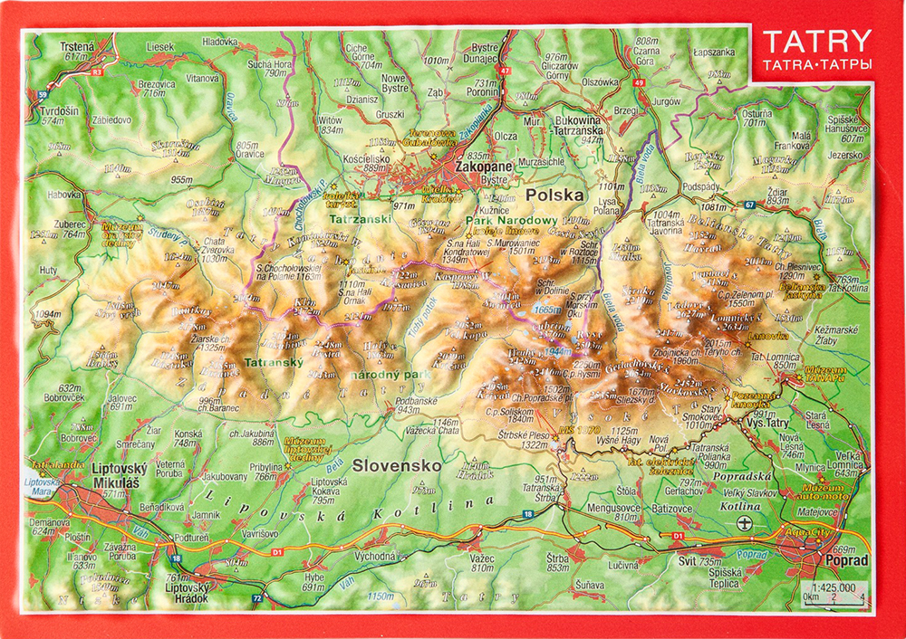
High Tatra

3,95 €

incl. 19% VAT excl. Shipping

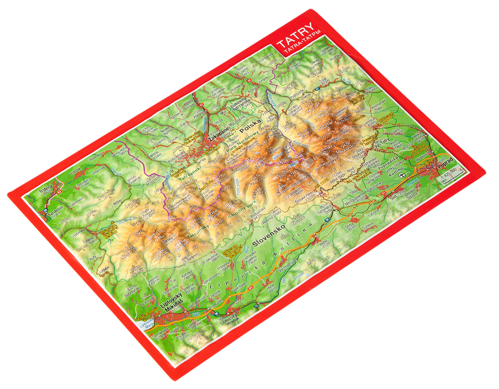
– Dimensions: 148 x 105 x 5mm

– Scale: 1: 475.000

– Boost factor: 1

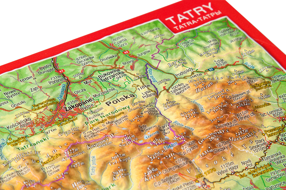
The High Tatras is the absolute highlight in Slovakia from a scenic point of view.

On the very appealing scale of 1:475,000 we have finished this jewel for you as a relief postcard.

SKU: 4280000664235 Categories: 3D Raised Relief Maps Europe, 3D Raised Relief Maps Mountains, All Products, Czech Republic Tags: 3D, Postkarte, Rahmen, Relief, rot, Tatra
  • Links in der Region
  • Description
Tourism High Tatras Slovakia
Tourism Zakopane
Tatra National Park

Description

Tips and suggestions for your stay in the region can be found here:

Legend has it that the creator of the world accidentally lost a stone over the present border between Poland and Slovakia. From this stone, the High Tatras would have emerged.

What or who deserves the thanks for this true natural paradise is ultimately unimportant. The highest mountains of Poland and Slovakia have gathered here to form a truly majestic backdrop. Brown bears, wolves, lynxes, golden eagles, wild chamois, and other rarities can still be found here in healthy populations. Already in 1948, almost the entire mountain range in the High Tatras National Park was placed under protection. For humans, the “smallest high mountain range in the world” has developed into a unique place to shake off everyday life and come a little closer to the original. In addition to hiking in this unbelievable scenery, other sports activities have become firmly established. Good cycle paths lead deep into the wild heart of the national park. In the winter months, the snow-covered landscape with wide downhill slopes and a multitude of professionally groomed cross-country ski runs is a delight. Zakopane on the Polish side, Tatranská Lomnica and Štrbské Pleso on the Slovak side are certainly the best prepared.

You may also like…

  • 1-Fach Display für Postkarten

    8,00 €

    incl. 19% VAT

    excl. Shipping

    Add to cart

Contact Germany

georelief Vertriebs GbR
Dohnaer Str. 383
D-01259 Dresden

Tel: +49 (0) 351 / 79 27 5100
Fax: +49 (0) 351 / 79 24 504
E-Mail: info@georelief.de

Our Partner in Schwitzerland

Georelief GmbH
Hauptstrasse 89
CH-8840 Einsiedeln

Tel: +41 (0) 554223315
Fax: +41 (0) 554223485
E-Mail: info@georelief.ch

Information

  • Imprint
  • Payment
  • Shipping
  • Terms and Conditions
  • Protection of data privacy
georelief © 2019. Alle Preise inkl. MwSt. zzgl. Versandkosten.
3D Rased Relief Map Saxon Switzerland Small 3D Raised Relief Map Swabian Alb Small
Scroll to top

In order to give you a better service georelief uses cookies. By continuing to browse the site you are agreeing to our use of cookies.

OK
  • EUR
    Euro
  • CHF
    Schweizer Frank