3D Raised Relief Map Saxony small
19,95 € – 39,95 €
incl. VAT excl. Shipping
– Dimensions: 390 x 290 x 20mm
– Scale: 1: 650.000
– Boost factor: 7
Our relief maps of Saxony depict the Free State on a scale of 1:1,200,000 or 1:2,400,000 with an elevation factor of 4. In comparison to other maps, the Ore Mountains, Saxon Switzerland, and Zittau Mountains literally push themselves towards the viewer. The experience of being able to feel a map is rounded off by a very detailed and harmoniously colored map image. Enrich your classroom, office or private environment with this decorative and knowledge-transferring product.
Description
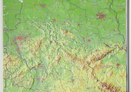
Details 3D Raised Relief Map Saxony: language german / scale 1:650.000
The large 3D Raised Relief Map Saxony from georelief are 100% made in Germany.
Because of that we can garantee high quality and topicality.
Tips and suggestions for your stay in the region can be found here:
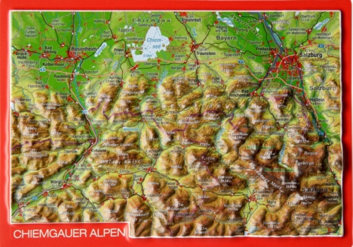
From 73 m at the Elbe crossing to Saxony to the 1214 m high Fichtelberg in the Ore Mountains, Saxony also has a lot to offer topographically.
The state capital Dresden presents itself to visitors as one of the cultural capitals of Europe. Semper Opera, Zwinger, Green Vault and much more will amaze you again and again. The nearby low mountain ranges such as the Zittau Mountains, Saxon Switzerland, the Ore Mountains, and the Vogtland offer breathing breaks while taking in the sights. But also, thanks to the open-cast lignite mine, extensive lake landscapes invite you to actively relax in the fresh air.
Contact Germany
georelief Vertriebs GbR
Dohnaer Str. 383
D-01259 Dresden
Tel: +49 (0) 351 / 79 27 5100
Fax: +49 (0) 351 / 79 24 504
E-Mail: info@georelief.de
Our Partner in Schwitzerland
Georelief GmbH
Hauptstrasse 89
CH-8840 Einsiedeln
Tel: +41 (0) 554223315
Fax: +41 (0) 554223485
E-Mail: info@georelief.ch